
Hello to, All My Dear Readers, Followers and My Blogging Friends ❤
Hope all of you are keeping well. It’s very cold but I am continuing to write, This is quite different from other days of winter having A series of cold fronts and northwest cloud bands will cause a mix of rain and snow across Australia this week, affecting parts of at least six states and territories.
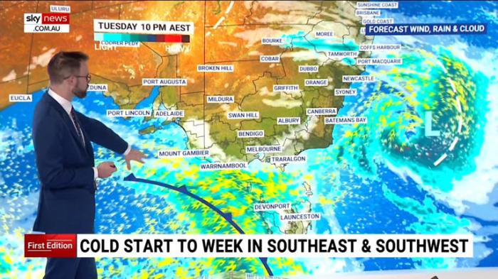
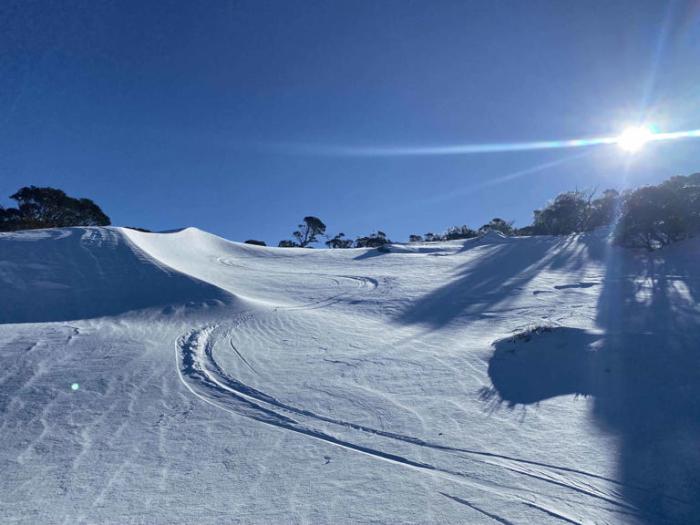
The speckled cloud over Australia’s southeast is associated with a cold air mass that brought snow to several states over the last 24 hours. This included snow to low levels in Tasmania and a top-up of fresh snow in the mainland Alps.
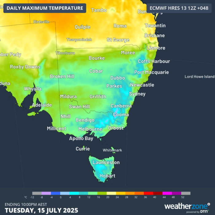
While rain and snow are now clearing from southeastern Australia, the cloud band in the west is going to cause rain to spread over several states during the next two days. The thick band of cloud will also keep a cap on daytime temperatures across parts of SA and NSW on Tuesday. Broken Hill is only forecast to reach a top of 12°C on Tuesday, which is 4°C below average for this time of year. If the temperature stays below 11.8°C on Tuesday, it will be Broken Hill’s coldest day so far this year.
Sydney could also struggle to climb very far above 15°C on Tuesday as increased cloud cover restricts heating across the city.
An interesting feature associated with one of this week’s cold fronts will be a weak northwest cloudband forming over parts of Queensland and NSW on Thursday and Friday. This fleeting cloudband won’t bring widespread heavy rain, but it could deliver about 10 to 20 mm of rain to parts of central and southern Qld and northeast NSW.
This cloudband will also cause cool daytime temperatures over parts of southeast Qld and northern NSW. Brisbane is currently forecast to reach 22°C on Friday but it might struggle to get above 20°C if cloud cover gets thick enough.
This will be a week of fluctuating temperatures featuring periods of wet and cloudy weather for parts of southern and eastern Australia. Check the latest forecasts and warnings in your area throughout the week for the most up-to-date details Cold fronts and another cloud band on the way
Later this week, two cold fronts will sweep across southern Australia and cause bursts of wind and showers in parts of WA, SA, Tas, Vic and southern NSW, along with dustings of alpine snow.
The first front will move across southern Australia from west to east between Tuesday night and Thursday. The second front will push across the country’s south in a similar fashion between Thursday night and Sunday. Both fronts will cause wintry conditions as blustery winds combine with cold air and showers.
🎉 Congrats! I am My Path! is getting noticed. GP Group Poster and 379 others have subscribed to your site.
Latest Update: 15th of July 2025. The website continues for the New and old Readers, Followers and Blogging Friends. This is “The 281 Post” and with the “Introductory Page this will be all in Total up to date, 282 posts. On Top Right-Hand side, you are able to see: The word “Menu” when you click on it. You will see the word “Home” All the posts from “The Very Beginning comes ~ Under “Home”. Which is The Introductory Page about: Who I am & Why I am Writing!
The new Topics “On the Left-Hand side “Under the Recent Posts, with “The latest Topics adding up”
As always, it is all free”. You can share and pass it on also for others who can benefit from this post. I hope All those who Read will be able to make the maximum use of all these facts and make, “Your Lives More Healthy and able to Lead Better lives in Happiness and Peace”. I wish it to be so as,” Peace which is our Ultimate Goal in Life ❤
Thanking the I net for the pictures and weather reports and information shared ❤
Sending Many Blessings of Good Health and Healing Energies your way ❤
May Gods Blessings Be Upon You ❤
Deepa Nilamani ❤

My brother lives near Melbourne. He was saying it was cold. Thank you.
LikeLiked by 1 person
Your are welcome Sending Many Blessings 😃
LikeLiked by 1 person